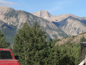
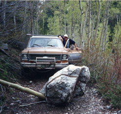
When it comes to touring the mountains on rough roads with a four-wheel-drive vehicle, Marble is one of the most popular destinations in the state. The popular Lead King Loop, which starts in Marble, goes through the splendidly scenic Lead King Basin, down through the ghost town of Crystal, and back to Marble, is a favorite trail with ATV, motocross, and 4WD enthusiasts.
However, Marble 4WD trails are somewhat limited, in that the town is surrounded by private property, steep mountains, cliffs, canyons, and wilderness areas where no vehicles are allowed. Please refer to the Four by Four Rules of the Road. To inquire about ATV permits visit the Colorado State Parks website or call (303) 866.3437.
Lead King Loop
With that in mind, the Lead King Loop and the rugged road over Schofield Pass to Gothic and Crested Butte are the only viable four-wheel-drive trails in the area. To access these routes, drive through Marble on County Road 3, past Beaver Lake on the right side. Soon after Beaver Lake you’ll see the old Gold Pan Gallery on the left, at the base of Daniels Hill. This is where you shift into four-wheel-drive.
If you’re riding ATV’s or motorcycles, park at the pull-off at the beginning of Beaver Lake and unload your rigs there. The Gold Pan Gallery has recently changed hands, and there is no parking available.
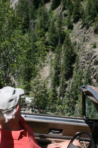
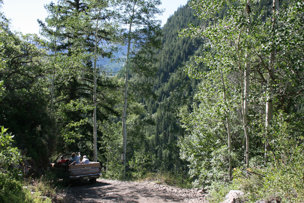
Daniels Hill is a steep grade, but not particularly difficult. Once you climb to a vantage point about ¾ mile up the trail, the road forks. You’ll know the spot by the cabins on the right with the red metal roofs. To drive the 5 miles to the old mill at Crystal, take the right fork. The road is definitely narrow, rugged, and a little scary for beginners, and requires four-wheel-drive, but it’s an intermediate 4×4 road accessible to practically every 4×4 vehicle. The road passes Lizard Lake, drops into the Crystal Canyon, and follows the river up to the Crystal Mill. The old mining town of Crystal, which is inhabited by a few hardy souls over the summer, is just a couple hundred yards further up the road. Drive slowly and respectfully through town. Please do not trespass at any of the houses in town. They are privately owned. If you’re lucky, the store might be open and you can buy a can of pop, a candy bar, or a chunk of crystals or other minerals.
At Crystal, the going gets tough. You have three choices: go back the way you came; complete the loop through Lead King Basin; or drive on to Crested Butte via Schofield Pass.
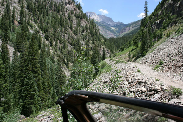
The road through town accesses both of the Lead King Basin and Crested Butte options. To complete the Lead King Loop, be advised that the road from Crystal to Lead King Basin is very rough and narrow. Low-slung vehicles such as Ford Explorers and Suburbans will definitely drag bottom on sharp rocks in several places. The road climbs up a mountainside and rejoins the Crystal River as it tumbles down a series of limestone cliffs. Those same cliffs are represented in the road as sharp stairsteps of limestone that require quite a bit of skill to negotiate.
Oversize vehicles such as full-size four-door pickups will have difficulty with the route. The absolute maximum vehicle size is a Ford F250 four-door with a short box. Even this rig has great difficulty making its way around one particular rocky point with a sheer drop-off on the other side. Smaller rigs such as full-size Broncos, older Chevy Blazers, CJ-7’s, and full-size straight-cab pickups shouldn’t have too much problem, as well as smaller rigs such as Toyota and Nissan pickups and mid-size SUV’s such as Nissan 4Runners and Jeep Cherokees. Drivers of Yukons and Suburbans should watch out—it’s possible to make the loop, but you could knock off your oil pan. ATV and dirt bike riders will have fun.
You’ll know it when you reach Lead King Basin. The road emerges from the trees into a gorgeous alpine basin with a waterfall cascading down from Geneva Lake. There is a bridge to the left crossing the Crystal River. There is also a river crossing straight ahead. Please do not use the river crossing. It’s extremely damaging to the environment. Use the bridge. A couple hundred yards above the bridge is a Forest Service parking lot and trailhead. Please park in the parking lot. Do not park off the road. Do not drive off the road. Help protect these precious and unique natural resources!
There is one cabin located in Lead King Basin. It is the home of Paul Harris, otherwise known as Lead King Paul, and is located adjacent to the bridge over the Crystal. Some have labeled Paul a hermit over the years, but that’s not true. Paul likes living in one of the most beautiful places in the world, and he is friendly and generally easy to get along with. Please respect that Paul’s cabin is private property.
The trailhead in Lead King Basin is the gateway to the Snowmass/Maroon Bells Wilderness Area beyond. The U.S. Forest Service requires that hikers, horseback riders, and other wilderness users sign in at the trailhead. No vehicles, motorcycles, ATV’s, bicycles, chain saws, or hang gliders may be brought into the wilderness. The trail accesses Geneva Lake and Little Gem Lake, Trail Rider Pass, Fravert Basin, Hasley Basin, and the North Fork of the Crystal River. Check here to find out more about the trails in the Marble area.
To complete the Lead King Basin loop, drive past the trailhead and begin ascending the switchbacks up the west side of Lead King Basin. This mountainside is home to some of the most spectacular wildflowers in Colorado during the peak wildflower season of the third week of July. The road is relatively safe, though it is composed of soft shale and it becomes extremely slippery when wet. We do not recommend travel when the road is wet. It can be very dangerous and cause damage to the road. Remember, you are out in the wilderness, if you get stuck you can’t just call 911. Please keep the mountainside pristine and yourself and others safe.
Once you crest the top of Lead King Basin, you will drive back down between Arkansas Mountain and Sheep Mountain. Near the top of Lead King Basin there are some very tight switchbacks that may cause you to back up and try again, depending on your wheelbase. When these switchbacks are slippery, it can be very tricky driving. There are also a couple of gullies where the road is hanging on by a couple of sticks of old railroad rails jammed into the ground, and those crossings are very narrow. Proceed with caution.
Down the mountain, you’ll see a turnoff for Sheep Mountain to your left. This is private property.
About 2.5 miles after cresting the mountain out of Lead King Basin, you will complete the loop at the top of Daniels Hill. Of course, the loop can be driven the other way around, too, starting by going up Arkansas Mountain, dropping into Lead King Basin, down into Crystal, and back out to Marble. When driving up Arkansas, don’t be fooled by the jeep road that goes up Sheep Mountain to the right. You need to bear left to stay on the Lead King Basin loop. If driven at safe speeds with no unusual road conditions, the loop takes about 3-4 hours in a 4WD vehicle, faster if on a motorcycle or ATV.
Schofield Pass
From the town of Crystal, drive straight through town. The road climbs up the hill to the east of town, and then forks left to go to Lead King Basin and goes straight to go over Schofield Pass. You should definitely check our Road Conditions. Quite often there are winter avalanches that don’t melt until the middle of the summer, or rockslides that haven’t been cleared away.
Schofield Pass can be a very difficult jeep road. Though it is listed on some websites such as MapQuest as a through road, there is no plowing or maintenance performed on the road and it is considered closed by Gunnison County. On one particular section, the road is carved out of a sheer granite face, barely wide enough for one jeep to pass, 12% grade, and a sheer cliff beneath you into the Crystal River. The Devil’s Punchbowl has several wrecked jeeps that have tumbled off the cliff piled on top of one another, and over a dozen people have died in jeep accidents in that spot.
The road is a very long shortcut from Marble to Crested Butte. Yes, it’s a shorter drive, but it’ll take you a long time. The old mining townsite of Schofield lies in a flat mountain park in between, just a couple of miles from Crystal, but on the other side of the Devil’s Punchbowl. Once you’ve reached Schofield, which is the site of a few backwoods cabins, the road is fairly smooth driving to the old mining town of Gothic, a few miles from Crested Butte.
4×4 Rules of the Road
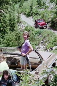
- Uphill driver has right of way. If you’re headed downhill and encounter a driver coming uphill, find a place to pull off so he can keep his momentum.
- Horses and livestock have right of way. Many of the Marble jeep roads are also used by horseback riders and sheep ranchers. If you encounter horses, pull off the road and stop your engine. If you push through a string of horses, you may cause a dangerous situation. Mountain bikers are obligated to STOP and let horses pass.
- Keep your vehicle on the road. No trailblazing allowed. Nowhere in the Marble area are you welcome to drive your vehicle off the road, unless it’s on private property that you own. Driving off the road causes irreparable damage to the terrain. In many areas, if you drive off the road you will be entering designated wilderness areas, which results in fines from government agencies.
- Drive at a reasonable speed. You won’t be the only driver on the road and you might end up in an accident with another vehicle, a horse, or a hiker.
- You pay the towing bill. If you get stuck in the backcountry, you’re obligated to pay the towing bill. Backcountry towing bills can run $800 or more, so our advice is, don’t get stuck!
- Bring appropriate gear. The weather can often change quickly in the high country, and you could end up staying longer than you had planned. Bring an axe, chains, a handyman jack, and a tow rope or chain. A sleeping bag is a good idea for emergency situations. Bring extra clothes, food, water, and a camera, because it’s pretty up there!
- Pack out your trash. There isn’t a trash service that comes to clean out fire rings and campsites. If you pack it in, pack it out.
- Dogs must be on a leash. Dogs can spook or stress wildlife, horses, and other backcountry users. Regulations require that dogs must be leashed at all times.
