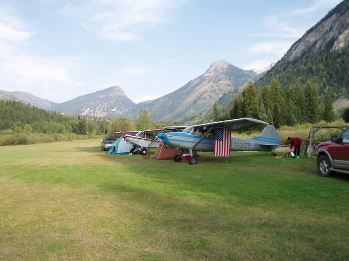
For such a small town, Marble has a lot of amenities, including its own 4,000-foot airstrip. The grass strip is privately owned and maintained, but open to the public through the generosity of its owners, Glen and Diane Gallegos, who notes that the Marble airstrip is the last high-mountain airstrip that is open to the public.
Annual Fly-in
The Colorado Pilots Association sponsors a fly-in to the Marble airstrip at least once a year, usually in September. Up to 40 planes, including some Korean War-vintage training planes, converge on the sunny airstrip surrounded by aspens in full fall colors. The fly-in is organized by Bill Meine, who can be reached at (303) 748.4588. Please read important information regarding permission and landing instructions for this private airport.
Pilots who wish to fly into Marble should note several things:
- Pilots must receive permission from Glen and Diane Gallegos to land in Marble. They can be reached at (970) 243.1565, or sometimes in Marble during the summer months at (970) 963.8605, or you can email them at dhgallegos@msn.com. Pilots must sign a waiver and receive landing information in order to use this private airport. Additional information is available on the CPA website: Coloradopilots.org. Please read important information regarding permission and landing instructions for this private airport on this link.
- Anyone who wishes to fly into Marble must be an experienced mountain pilot. The airstrip has no tower and is ringed by tall mountains. The runway is fairly smooth and is in pretty good shape. It’s actually 4,600 feet long, but, as former owner Bob Conger noted, “The last 600 feet on the east end are in pretty rough shape.”
- Overfly the airstrip before landing. Pilots should note that the airstrip has no fencing and it’s possible to encounter deer, elk, and the occasional horseback rider, mountain biker, or fisherman crossing the airstrip.
- The airstrip is covered with snow from late November to late April most years, depending on snowfall and day-to-day conditions. If pilots try to land with skis, they should note that snowmobilers often play on the airstrip in the winter, making tracks that could cause a difficult landing. Contact Colorado Department of Transportation for information on road conditions in Marble.
- The airstrip is located adjacent to County Road 3 near Mile Marker 4, between the Hermit’s Hideaway and the Serpentine Trail turnoffs. The coordinates are N 39 degrees, 6.5 minutes, West 107 degrees, 12.8 minutes. The airstrip is situated at 7,800 feet in elevation.
- Some of the Marble lodging establishments are located near the airstrip, and most of the Marble Tourism Association lodges can arrange a pick-up at the airstrip. Marble has one restaurant, Woody’s Cookshack… However, almost all lodging establishments have kitchens, so pilots and passengers should bring a cooler of food for their stay.

