- East Creek Trail
- Hawk Creek
- Lily Lake/Kline Creek Trail
- Placita Trail
- Lily Lake Trail
- Carbonate Creek/Buckskin Basin/Avalanche Creek/Lost Trail Creek/Silver Creek
- Lost Trail Creek trail, the trail to Silver Creek and the back side of Arkansas Mountain
- Meadow Mountain to Geneva Lake
- Geneva Lake/North Fork of the Crystal/Love’s Cabin/Hasley Basin/Fravert Basin/Frigidaire Pass/Schofield
- Trail Rider Pass
- North Fork of the Crystal
- Love’s Cabin
- Hasley Basin
There are so many wilderness hiking and horseback trails in the Marble area that it is hard to name them all. Several of the trailheads begin right in or near the town itself, and excursions on these trails can range from a half-hour hike to a week-long trek. All the trails listed here are for horseback or foot users only. None of these trails are accessible by ATV, motorcycle or mountain bike.
East Creek/Gift Creek/Avalanche Creek/Hawk Creek/Kline Creek/Lily Lake
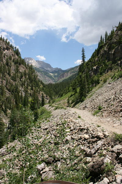
The East Creek Trail starts right above the town of Redstone at the water treatment plant, which is at 7,200 feet in elevation. The entry point to the trail is at the north end of town, past the last house. There’s a wide parking area on the east side of Redstone Boulevard, leading into a jeep road going half a mile up to the water plant. This is a very narrow, steep road with no turnouts. We suggest you park below on the north end of Redstone Boulevard. The East Creek Trail is a beautiful 3 ½ -mile climb through red sandstone formations, with a lovely creek adjacent to the trail. It is steep, cresting out at 12,200 feet before dropping over into Gift Creek, where it continues downhill until it ties into the Avalanche Creek trail.
Approximately 1 mile up the East Creek Trail, the trail forks off (right) south to Hawk Creek. This trail is important for Marble visitors, because it ultimately leads back to Marble. The proper name for this trail is the
Lily Lake/Kline Creek Trail, or 1964 Trail. Do not think that you can start on this trail late in the morning and make it to Marble in the daylight, whether on horseback or on foot. There are three passes, the highest of which (Hawk Ridge) is 10,600 feet. It’s a comfortable 2-day hike or a brutal all-day hike of 10 miles through very difficult terrain. The trail is steep, rocky, and poorly marked in places, and in several places it crosses sandstone outcroppings that become very slick, wet or dry. Hikers will have better footing than horseback riders. It crosses through four basins: Hawk Creek, Little Kline, Big Kline, and Placita, before it crests out on the northwest rim of Elk Mountain. Once on Elk Mountain, it’s an easy downhill jaunt through massive groves of aspens and scrub oaks for 3 ½ miles before you reach the Darien Ranch in Marble. NOTE: The Dariens, owners of the Ute Meadows Inn, own the access to the Lily Lake Trail, which is locked off. For permission to use the access contact Ute Meadows Inn.
When starting at the Darien Ranch, the trail begins right next to the bridge crossing the Crystal near Mile Marker 3 on County Road 3. Again, please check with the Dariens for access permission.
Of course, it’s not necessary to traverse the entire length of the trail from Redstone to Marble. Day hikers can hike in for an hour or two and then back out. For those going on longer expeditions, hikers and riders can make forays up into Little Kline and Big Kline on old sheepherder trails, but these trails are unmarked, not maintained, and not on the maps. Quite often these trails are clogged with downed timber or washed out in steep gullies.
Please be advised that although Highway 133 is not far below the Lily Lake/Kline Creek trail, there is no possibility to shortcut down to the highway until you reach the Placita Trail. There are significant cliffs between the trail and the highway, and your chances of getting “cliffed out” are excellent.
Placita, which means “placid” or “pleasing” in Spanish, is the wide spot in the valley on the east side of the Crystal River along Highway 133 between the County Road 3 turnoff to Marble and Redstone. At Mile Marker _____, the road crosses the river and there is a jeep road immediately adjacent to the bridge on the east side of the road. This jeep road crosses private land for half a mile along the east side of the river, then climbs up a hill, where there is a parking area and trailhead.
The Placita Trail heads straight east, and, some would say, straight up for a mile, where it intersects with the Kline Creek/Lily Lake Trail, designated Trail 1964 by the U.S. Forest Service. The trail climbs up 2,300 vertical feet through stands of Gambel oak into vast groves of aspen trees. There’s not much visibility on the trail except for stands of aspen and straight across the valley to Huntsman’s Ridge. We classify this trail as a difficult trail, especially for horses.
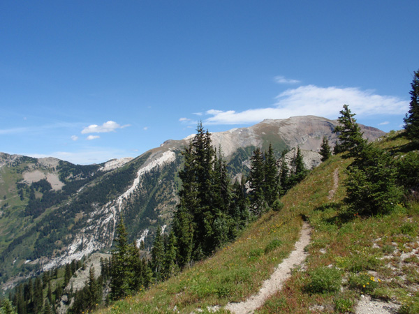
The views along the Lily Lake/Kline Creek Trail are outstanding, particularly from the ridge of Elk Mountain looking south to Chair Mountain. There are several other vantage points along the trail with spectacular views. The geologic formations range from Mancos shale on Elk Mountain to red Maroon Formation sandstone from Little Kline to East Creek. There are many groves of aspens, dark timber (spruce and fir), scrub oak, open meadows, and pristine wilderness.
If you start on the Lily Lake Trail at the Darien Ranch near Marble (ask for permission at the Ute Meadows Inn first), the first stop after 45 minutes’ hiking is Lily Lake, a lovely 10-acre lake on Elk Mountain. (After 5 minutes the trail forks right and left. Take the left fork to climb up to Lily Lake). It is located primarily on private property, though the western edge is on public land. Lily Lake is shallow (sorry, no fish in it), and in June, water lilies bloom along the edge of the lake. North of the lake are fairly extensive holdings of private property, so do not travel along the jeep road past the gate, north of the house and barns at Lily Lake.
The trail winds around Lily Lake and joins up with the jeep road that goes to the private house at Lily Lake. There is an old Forest Service ranger station (available for overnight stays through OutWest Guides) LINK and the trail takes off to go higher up the mountain right from the ranger station.
NOTE FOR TRAIL USERS: There are no fish in Lily Lake, Hawk Creek, Little Kline Creek, Big Kline Creek, or East Creek. There is plenty of water for livestock along the way, and the creeks are generally clean and fast-flowing. Hikers are advised to bring their own water, though there are springs bubbling out along the creek banks. There is no cell phone reception along the way. This trail is infrequently traveled, and you should count on self-rescue in case of trouble. Hikers and horses should be fit and trim for this trail. This is NOT a “walk in the park.”
Carbonate Creek/Buckskin Basin/Avalanche Creek/Lost Trail Creek/Silver Creek
The starting point for this network of trails is right in the town of Marble. The Carbonate Creek trail starts right behind the Beaver Lake Lodge on the east side of town. It goes straight north up the hill behind the lodge, crossing through private property for the first 1 ½ miles of the trail. The trail here is on the sunny side of the mountain, and the footing is loose shale in places. It’s a pleasant hike with great views across the valley for day hikers.
At the base of the now-defunct Marble Ski Area, the trail emerges onto National Forest lands and crosses Carbonate Creek. Just on the other side of the creek, the trail climbs up a very steep incline. BE ADVISED that the trail is in imminent danger of falling into the creek in two locations. It’s situated on an unconsolidated slope with overhangs above the creek 40 feet below. It would be wise, especially for horseback riders, to bushwhack across the mountain to gain elevation until you rejoin the trail.
The trail ascends through aspen groves and open meadows with lovely vistas for a total of 3 miles until you reach a waterfall at the edge of Mount Daley. The elevation at this point is 10,200 feet. From this point, the trail goes around the back side of Mount Daley to Buckskin Basin, climbing steeply up the basin to crest out at 12,000 feet. Only a couple hundred yards north from the crest of Buckskin Basin is Avalanche Pass, a trail that takes off straight north to drop down into West Avalanche Creek.
Instead of taking off to Avalanche Creek, most trail users drop back down into Lost Trail Creek. The trail descends steeply into a scree field and then joins up with the Lost Trail Creek trail. If you go right (west), you head towards the top of the defunct Marble Ski Area. If on horseback, be careful where the trail crosses a gully that is actively eroding. If you go left (east), you join up with the trail that goes back down Lost Trail Creek and joins up with the Arkansas Mountain jeep road leading to Lead King Basin. By the way, the views are absolutely spectacular at this point of the trail as you look across to Treasure Mountain, Whitehouse Peak, and the Yule Creek basin and Raspberry Ridge.
However, just a couple hundred yards after the Buckskin Basin trail joins up with the Lost Trail Creek trail, the trail to Silver Creek and the back side of Arkansas Mountain takes off to the left (east) as you’re going downhill. If you’re coming from the bottom, from Lost Trail Creek, the Silver Creek trail is found immediately after you climb into the dark timber after climbing up the spine between the two creeks.
This trail goes about two miles to the east, through stands of dark timber and open meadows, and then drops into the Silver Creek basin. At the divide between Arkansas Mountain and Silver Creek, another trail takes off to the north, up to the summit of East Avalanche Pass. The trail then drops into the Avalanche Basin. This juncture is also very scenic. Looking straight to the east, you can see the peaks of the Maroon Bells above Fravert Basin. In the middle ground is the east side of Lead King Basin, and to the south is the dominating ridgeline of Treasure Mountain. The foreground is a gorgeous open basin above treeline that is on the cover of several books.
The trail gives you two choices: either zigzag to the south along Silver Creek and then down to the jeep road at the top of Lead King Basin, or freelance across the open bowl to the top of the next ridge, and pick up the cairns and trail that leads across the face of Meadow Mountain to Geneva Lake. The trail across Meadow Mountain to Geneva Lake is an old sheepherder’s trail marked by stone cairns. Several sections of the trail are very tricky to negotiate, and if you’re on horseback, you’ll likely be walking and leading your horse. It’s very exposed and the consequences of slipping and falling are severe. It takes about half an hour to an hour to negotiate. This route is definitely not recommended if thunderstorms are approaching or if the trail is wet.
Geneva Lake/North Fork of the Crystal/Love’s Cabin/Hasley Basin/Fravert Basin/Frigidaire Pass/Schofield
As you can tell by the above description, this is an extensive network of trails beginning with the trailhead in Lead King Basin as the hub. From the trailhead itself (make sure to park in the Forest Service parking area, and not in the wilderness), the trail heads north up Lead King Basin. At the head of the basin, underneath Snowmass Peak and Hagerman Peak, are the spectacular waterfalls emanating from Geneva Lake. Half a mile up the trail, you’ll see a sign pointing uphill (west) and to the left for the trail to Geneva Lake. There is a popular wilderness camping area with no improvements at Geneva Lake. It takes about 1½-2 hours to hike to Geneva Lake from Lead King Basin, depending on how much gear you’re packing. The campsites can be fairly busy during the middle of summer. Fishing in the lake is good for brook trout.
From Geneva Lake, the trail winds around the back (north) side of the lake and climbs the ridge on the east side of Geneva Lake. Once you’ve crested the ridge, the trail keeps the same elevation for a mile or so, high on the side of the mountain overlooking the North Fork of the Crystal River. After a mile, the trail joins up with the Trail Rider Pass. Trail that climbs the shoulder of Hagerman Peak and drops down the other side into Snowmass Lake. From the junction with the Geneva Lake trail, it’s about a mile to the summit of Trail Rider Pass. There are several nasty switchbacks as you approach the summit, and horseback riders might want to walk. The views from Trail Rider Pass are spectacular—to the south, the top of Hasley Basin and Treasure Mountain; to the east, the Maroon Bells; just above, Hagerman Peak and Snowmass Peak; and to the north, the entire basin containing Snowmass Lake and leading down into Snowmass Ski Area.
At the juncture with Trail Rider Pass Trail, however, hikers and riders can choose to descend to the pack trail leading up through the North Fork of the Crystal. This is the same trail that begins in the bottom of Lead King Basin, and from which you departed to go to Geneva Lake. It’s a steep descent into the basin, with loose footing and many switchbacks. If you choose to ride up Trail Rider Pass from the bottom, make sure your horses are in shape and know how to climb. It will test the endurance and strength of even the best-trained, fittest horse, and if your horses aren’t used to the demands, either you’ll be walking or your horses will rear up and flip over on you. Backpackers will have a tough ascent from the North Fork of the Crystal to Trail Rider Pass. It’s very steep, very high elevation, and very demanding.
If you choose to bypass Geneva Lake and keep going up the North Fork of the Crystal, look forward to an easy hike, lovely views, lots of wildlife and wildflowers, open meadows, and intermittent timber. There are several springs alongside the trail that offer clean water—partake at your own risk, but the water is clean, according to our unscientific samplings. The river is within view of the trail at almost all times, and it is a lovely river. The trail finally crosses the river at a wide meadow, which is called “Love’s Cabin.” This is the site of one of OutWest Guides’ summer camps for their overnight trips. There used to be a sheepherder’s cabin there, but there is no longer any evidence of a structure.
Please note that camping is not allowed within 100 feet of the trail, no matter what evidence you see of previous campsites, and if you intend to camp here, keep your campsite spotlessly clean when you leave. Fishing is good for brook trout in the river, but don’t kill more than a few. They do not regenerate quickly.
From Love’s Cabin, which is about 4 miles up the trail from Lead King Basin, you have the choice of proceeding up to the waterfall at the head of the basin to the east or trekking up Hasley Basin, directly to the south. Hasley Basin is a beautiful, wide basin that is shrouded with timber below and gives way to high-alpine meadows above. It looks across to the peaks of the Maroon Bells and the ridge between the Bells and Hagerman Peak.
The trail heads straight south up through Hasley Basin and, after a steep climb for the last mile, crests the ridge looking down into West Maroon Pass. However, just before the summit of the pass, known as Paint Horse Pass, a trail takes off to the east that heads across a scree field and north over into Frigid Air Pass. Frigid Air Pass is fairly steep and has quite a few switchbacks, and crests out at close to 12,800 feet. It drops down into Fravert Basin, then heads back to the west and back down to Love’s Cabin. This loop takes almost a day by horseback and will be quite a journey on foot.
If you choose to keep heading south from Paint Horse Pass, you have the choice of joining up with the West Maroon Creek trail or freelancing a little bit and heading south to the old sheepherder’s trail that follows the mountain overlooking the old townsite of Schofield. This trail runs east/west for a couple of miles at approximately the same elevation above timberline. Eventually it comes out on top of Mineral Point and then plunges down the mountain on the east side of Lead King Basin and until it reaches the road near Lead King Paul’s cabin at the bottom of Lead King Basin. It’s an exciting loop that can take several days to explore it all.
